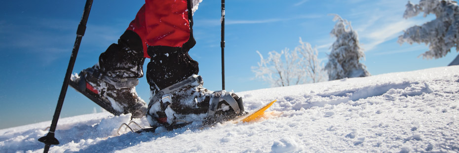
10 Colorado Trails for Snowshoeing Beginners
With the promise of winter storms in Colorado become a reality quickly, many mountains are slated to receive between 8 and 24 inches of snow by Saturday morning. The snowfall was supposed to come in two separate waves, with one cell hitting from Tuesday night to Wednesday night and the second, larger cell, arriving Thursday morning and sticking around until Saturday. The most powder is expected to accumulate on Friday (as we are currently seeing), with scattered pockets remaining into Saturday morning.
This anticipated snowfall undoubtedly elicits a variety of responses from Coloradans, while I can imagine some people are eagerly shining their skis and washing their snow pants, there are certainly others who are cranking up the heater and making a last minute run to Trader Joes.
Personally, I would say I fit pretty snuggly in the first category, although, to be fair, I don’t actually own a pair of skis; I just love snow, and as a snow lover I am ashamed to say I’ve never had the chance to go snowshoeing. With 10 inches of fresh powder on the way I figured this weekend would be a great time to start, and considering that many of you are probably snowshoe rookies like me I decided to put together a list of some of the best snowshoeing spots in Colorado.
This list is by no means intended to be totally inclusive; especially considering you can snowshoe on pretty much any trail you can hike at (provided you have snow and snowshoes of course), it is more meant to be a starting point for those like me trying to give the hobby a try.
- The Colorado Trail: The Colorado Trail is Colorado’s premier long distance trail. Stretching almost 500 miles from Denver to Durango, it travels through the spectacular Colorado Rocky Mountains amongst peaks with lakes, creeks and diverse ecosystems. Trail users experience six wilderness areas and eight mountain ranges topping out at 13,271 feet, just below Coney Summit at 13,334 feet. The average elevation is over 10,300 feet and it rises and falls dramatically. Users traveling from Denver to Durango will climb 89,354 feet.
- Grand Mesa, near Grand Junction: “The Mesa” is a 53-square-mile, flat-topped mountain that the Ute Indians considered sacred. With a 10,000-foot elevation, 300 inches of snow but minimal winter infrastructure, it is a vast, virtually private winter sports playground.
- Arapaho Glacier Trail: The Arapaho Glacier Trail leads northward from the Rainbow Lakes Trailhead (located before the Rainbow Lakes Campground) and enters the Indian Peaks Wilderness. Climbing through the woods for about two miles, the trail exits onto the open tundra with a fine view into the City of Boulder Watershed. After several switchbacks, the Arapaho Glacier Trail crosses to the south side of the ridge. At its highest point, the trail offers a spectacular overlook of the Arapaho Glacier, South Arapaho Peak (elevation 13,397′), and North Arapaho Peak (elevation 13,502′).
- Hanging Lake Trail: Hanging Lake is a crystal-clear, travertine lake located high atop the cliffs of Glenwood Canyon. Suspended on the edge of Glenwood Canyon‘s cliffs, the clear turquoise lake and the waterfalls that spill into it are a breathtaking sight after the rigorous uphill climb. The mile-long hike is steep and rigorous, but rewarding once you see the natural beauty that awaits you at the top.
- Rabbit Ears Pass: In the winter, Rabbit Ears Pass is known as the state’s snowmobiling mecca. Due in part to its close proximity to nearby Steamboat Springs many offerings of winter activities, the pass’s unsurpassed wilderness offers beginner through expert snowmobilers many opportunities for free riding or guided tours. Snowshoeing and cross-country skiing are also popular alternatives to snowmobiling.
- Lost Lake Trail: Lost Lake via Hessie Trail is a 4.1 mile heavily trafficked loop trail located near Nederland, Colorado that features a lake and is rated as moderate. The trail offers a number of activity options and is accessible year-round. Dogs are also able to use this trail but must be kept on leash.
- Elk Creek Falls Trail: Elk Falls is located 5.18 miles from the Ranch Hand picnic area in Staunton State Park. This 75-foot fall pours over granite cliffs into North Elk Creek with good views of the Lion’s Head formation. The long but moderate hike to Elk Falls passes through mixed forests and montane grasslands before making the steep, chain-aided descent to the falls viewing area. Visitors will enjoy varied terrain and open landscapes on the hike to Elk Falls:
- Bear Lake Trail: The Bear Lake Loop in Rocky Mountain National Park is located at the end of Bear Lake Road, 9 miles from the turn-off at Highway 36. Due to the extreme popularity of the area you may want to consider using the free park shuttle to reach the trailhead during peak tourist season. Although the hard packed surface of the Bear Lake Nature Trail is considered to be a moderately accessible trail, there are a couple of relatively steep sections in some places. All in all, however, the Bear Lake Nature Trail is an ideal destination for the entire family.
- Brainard Lake Trails: Serving as a gateway to the Indian Peaks Wilderness, the Brainard Lake Recreation area is a highly popular trailhead and campground in the Roosevelt National Forest near Ward, Colorado. Together with views of the Indian Peaks to the west as well as trails that lead to several alpine lakes, a small glacier and the adjacent Indian Peaks Wilderness, the Brainard Lake Recreation area offers a popular and worthwhile destination.
- Burning Bear Trail: This pleasant 5.5 miles trail follows the Burning Bear Creek west from Geneva Creek, up over a ridge, and down the Burning Bear Creek on the west side of the ridge as it drains west into the North Fork of the South Platte River in Hall Valley. The trail is accessible for hikers, horses and bicycles. Allow approximately 2 ½ to 3 hours to hike the entire trail. The hike from the Geneva Creek Trailhead to the ridge summit will take about 90 minutes at a moderate pace.
If you find yourself on one of these trails (or blazing your own path on a trail close to home), tag us in pictures and send us your stories for a chance to be featured in our upcoming content.


